File:Chesapeake bay watershed map.jpg
No higher resolution available.
Chesapeake_bay_watershed_map.jpg (330 × 300 pixels, file size: 47 KB, MIME type: image/jpeg)
Summary
| Description | |
| Date | |
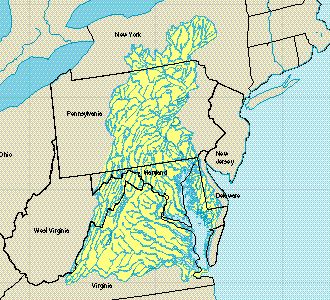
| Source | From the U.S. Geological Survey report Status and Trends of the Nation's Biological Resources [1], specifically the chapter "Trends in the Chesapeake Bay Watershed Wetlands"[2]. |
| Author | U.S. Geological Survey |
| Permission (Reusing this file) |
Public Domain (U.S. Government work) |
Licensing
This image is in the public domain in the United States because it only contains materials that originally came from the United States Geological Survey, an agency of the United States Department of the Interior. For more information, see the official USGS copyright policy.
|
File history
Click on a date/time to view the file as it appeared at that time.
| Date/Time | Thumbnail | Dimensions | User | Comment | |
|---|---|---|---|---|---|
| current | 21:16, 28 September 2004 | | 330 × 300 (47 KB) | wikimediacommons>Tcr25 | {{PD-USGov}} Map of the Chesapeake Bay Watershed |
File usage
The following page uses this file: