Virginia and US History SOL map study: US expansion 1789-1959

From A+ Club Lesson Planner & Study Guide
Revision as of 14:08, 31 May 2022 by Bromley (talk | contribs)

Preparation for the state of Virginian SOL ("Standards of Learning") History test: US expansion 1789-1959

Early Republic, 1789-1820[edit | edit source]

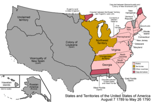
1790s
US after becoming an independent nation
  • acquired the lands between
    • the Appalachian Mountains
    • Mississippi River
Organization of new territories between
  • claims of existing states (former 13 colonies)
  • federal territories created by Congress
    • especially the Northwest Territory

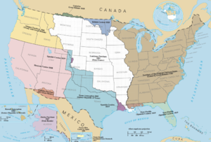
Territorial growth & Mexican-American War, 1820-1860[edit | edit source]

Slavery maps, to 1865[edit | edit source]

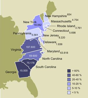
Slavery in American colonies as of 1770
Slavery in the 13 American colonies prior to the American Revolution
Animated map timeline of the expansion of slavery
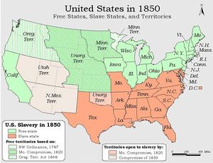
Distribution of free and slave states, 1850

Civil War, 1861-1865[edit | edit source]

Continental expansion & overseas territories, 1865-1900[edit | edit source]

20th century new states, 1900-1959[edit | edit source]


asdf[edit | edit source]

asdf[edit | edit source]
asdf[edit | edit source]