Virginia and US History SOL map study: 20th century wars: Difference between revisions
| Line 103: | Line 103: | ||
! | ! | ||
|- style="vertical-align:top;" | |- style="vertical-align:top;" | ||
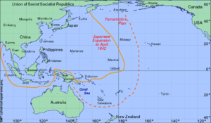
| | |[[File:Pacific war Japanese expansion april 1942.svg|none|thumb|Map showing the greatest extent of Japanese territorial control (solid line), with the dotted line indicating areas contested between the US and Japan.]][[File:Pacific War Japanese Advances med.jpg|thumb|alt=|border|left]] | ||
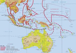
[[File:Pacific War Japanese Advances med.jpg|thumb|alt=|border|left]] | |||
| | | | ||
|- style="vertical-align:top;" | |- style="vertical-align:top;" | ||
| Line 112: | Line 111: | ||
|- style="vertical-align:top;" | |- style="vertical-align:top;" | ||
| | | | ||
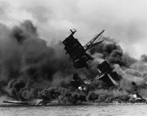
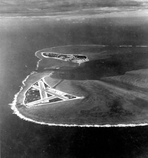
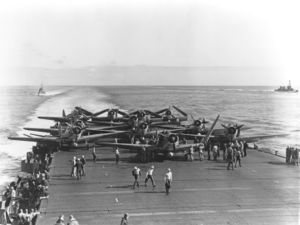
[[File:1941 Pearl-Harbor USS Arizona (BB-39) burning after the Japanese attack on Pearl Harbor - NARA 195617 - Edit.jpg|thumb|alt=|border| | [[File:1941 Pearl-Harbor USS Arizona (BB-39) burning after the Japanese attack on Pearl Harbor - NARA 195617 - Edit.jpg|thumb|alt=|border|none]][[File:Pacific war midway Aerial view of Midway Atoll on 24 November 1941 (80-G-451086) med.jpg|none|thumb|Midway "atoll" (small island) which was an important U.S. airbase in the middle of the Pacific Ocean. The failed Japanese attack on Midway in June 1942 is considered a "turning point" in the War. ]][[File:Pacific war Douglas TBD-1 Devastators of VT-6 are spotted for launch aboard USS Enterprise (CV-6) on 4 June 1942 (80-G-41686) med.jpg|none|thumb|The USS Enterprise aircraft carrier preparing to launch American dive-bombers to attack Japanese war vessels. Aircraft carriers were an essential weapon for both Japan and the United States.]] | ||
| | | | ||
|- style="vertical-align:top;" | |- style="vertical-align:top;" | ||
Revision as of 20:00, 5 June 2022
Preparation for the state of Virginian SOL ("Standards of Learning") History test: 20th century wars
Content: WWI, WWII, Cold War, Korean War & Vietnam War
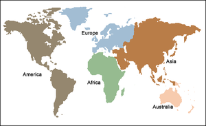
Purpose: to associate time, place and events via maps
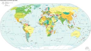
World maps[edit | edit source]
 |
|
 |
|
World War I[edit | edit source]
World War II[edit | edit source]
Origins of WWII
European Theatre
