Virginia and US History SOL map study: US expansion 1789-1959: Difference between revisions
| Line 45: | Line 45: | ||
** including into Spanish territories (modern Texas) | ** including into Spanish territories (modern Texas) | ||
|- style="vertical-align:top;" | |- style="vertical-align:top;" | ||
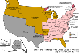
|[[File:1828 United States 1828-1834.png|left|thumb|1828: showing re-organization of the Louisiana territory and Mexican lands ]] | |[[File:1828 United States 1828-1834.png|border|left|thumb|1828: showing re-organization of the Louisiana territory and Mexican lands]] | ||
|'''Mexican Texas, 1827-1836 & Republic of Texas, 1836-1846''' | |'''Mexican Texas, 1827-1836 & Republic of Texas, 1836-1846''' | ||
Revision as of 19:55, 31 May 2022
Preparation for the state of Virginian SOL ("Standards of Learning") History test: US expansion 1789-1959
Early Republic, 1789-1820[edit | edit source]
Territorial growth & Mexican-American War, 1820-1860[edit | edit source]
Slavery maps, to 1865[edit | edit source]
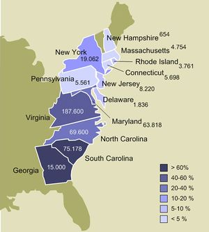 |
Slavery in the 13 American colonies prior to the American Revolution |
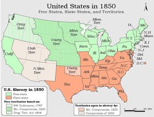 |
See this animated map timeline for expansion of slavery from colonial to Civil War period |
Civil War, 1861-1865[edit | edit source]
Continental expansion & overseas territories, 1865-1900[edit | edit source]
20th century new states, 1900-1959[edit | edit source]
asdf[edit | edit source]
