File:Oceania UN Geoscheme Regions.svg

Size of this PNG preview of this SVG file: 800 × 462 pixels. Other resolutions: 320 × 185 pixels | 640 × 370 pixels | 1,024 × 592 pixels | 1,280 × 740 pixels | 2,560 × 1,479 pixels | 900 × 520 pixels.
Original file (SVG file, nominally 900 × 520 pixels, file size: 128 KB)
Summary
This W3C-unspecified vector image was created with Adobe Illustrator.
| Description |
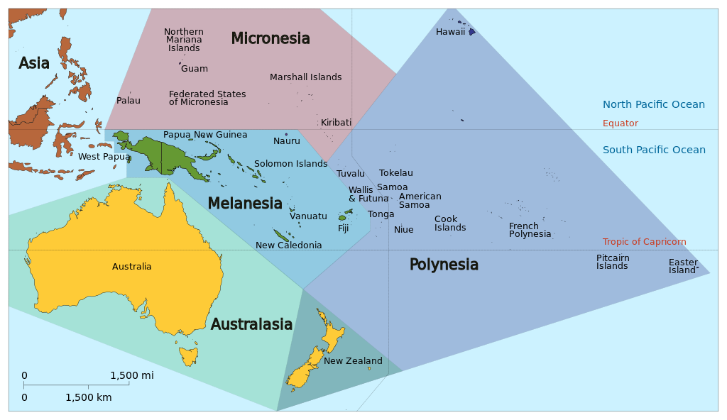
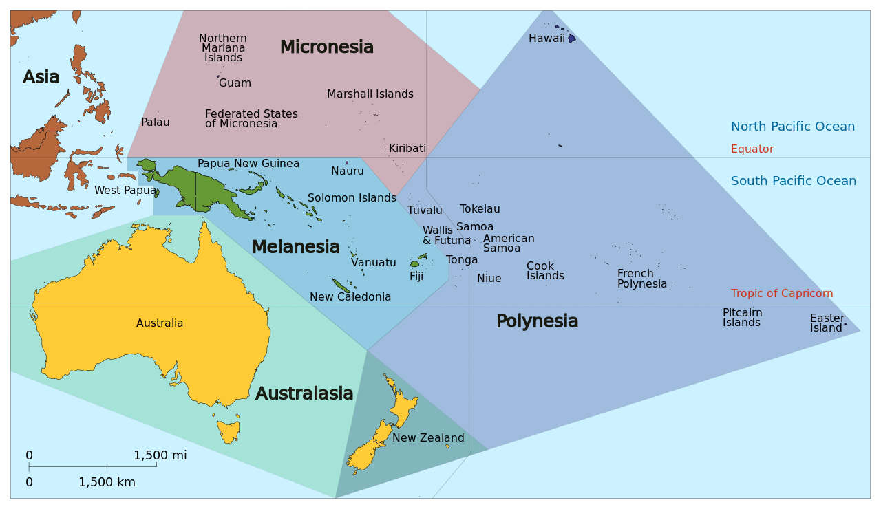
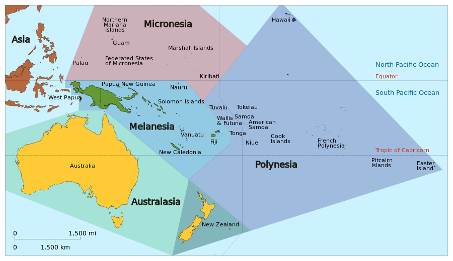
English: Map of Oceania based on the United Nations geoscheme M49 coding classification devised by the United Nations Statistics Division. Exceptions: New Zealand shown in both Australia (as per UN geozones) as well as Polynesia and so needs a qualifier description on any Wiki article; Hawaii and Easter Island shown which belong to USA and Chile in the 'Americas' geozone. SVG format. |
| Date | |
| Source | Own work, derivative of Oceania_ISO_3166-1.svg |
| Author |
|
| Other versions |
|


Licensing
I, the copyright holder of this work, hereby publish it under the following license:
This file is licensed under the Creative Commons Attribution-Share Alike 3.0 Unported license.
- You are free:
- to share – to copy, distribute and transmit the work
- to remix – to adapt the work
- Under the following conditions:
- attribution – You must give appropriate credit, provide a link to the license, and indicate if changes were made. You may do so in any reasonable manner, but not in any way that suggests the licensor endorses you or your use.
- share alike – If you remix, transform, or build upon the material, you must distribute your contributions under the same or compatible license as the original.
File history
Click on a date/time to view the file as it appeared at that time.
| Date/Time | Thumbnail | Dimensions | User | Comment | |
|---|---|---|---|---|---|
| current | 20:03, 17 January 2024 | | 900 × 520 (128 KB) | wikimediacommons>Theklan | File uploaded using svgtranslate tool (https://svgtranslate.toolforge.org/). Added translation for eu. |
File usage
The following page uses this file: