File:1782-1802 United States land claims and cessions 1782-1802.png
Size of this preview: 573 × 600 pixels. Other resolution: 747 × 782 pixels.
Original file (747 × 782 pixels, file size: 145 KB, MIME type: image/png)
Summary
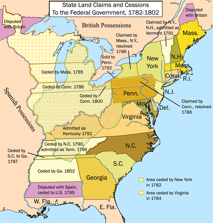
Territories of the United States after Independence (1783), as well as British Canada and Spanish Louisiana. The map shows the land claims of the thirteen states towards the west beyond the Appalachian Mountains (wikipedia)
Licensing
{{subst:wikipedia}}
File history
Click on a date/time to view the file as it appeared at that time.
| Date/Time | Thumbnail | Dimensions | User | Comment | |
|---|---|---|---|---|---|
| current | 18:23, 30 May 2022 | | 747 × 782 (145 KB) | Bromley (talk | contribs) | Territories of the United States after Independence (1783), as well as British Canada and Spanish Louisiana. The map shows the land claims of the thirteen states towards the west beyond the Appalachian Mountains (wikipedia) |
You cannot overwrite this file.
File usage
The following file is a duplicate of this file (more details):
- File:United States land claims and cessions 1782-1802.png from Wikimedia Commons
The following page uses this file: