File:1775 Map Thirteen Colonies 1775.svg

Size of this PNG preview of this SVG file: 800 × 550 pixels. Other resolution: 2,560 × 1,759 pixels.
Original file (SVG file, nominally 914 × 628 pixels, file size: 325 KB)
Summary
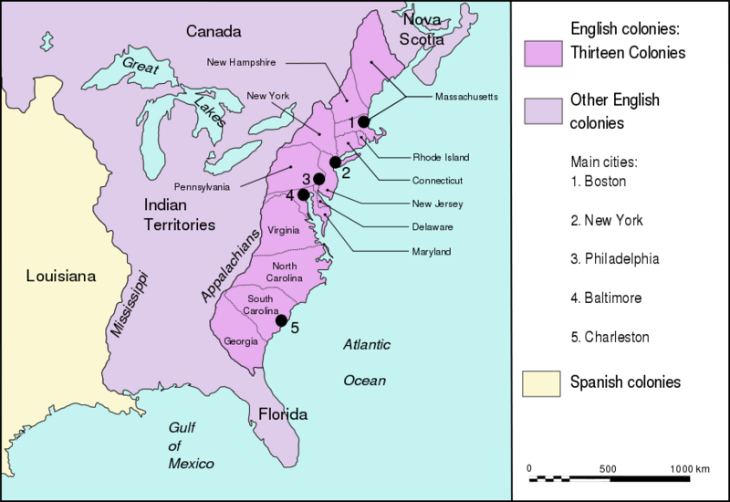
Territories of the 13 English colonies, British-controlled "Indian Territories," and Spanish Louisiana, just before the American Revolution (1775)
Licensing
{{subst:wikipedia}}
File history
Click on a date/time to view the file as it appeared at that time.
| Date/Time | Thumbnail | Dimensions | User | Comment | |
|---|---|---|---|---|---|
| current | 18:13, 30 May 2022 | | 914 × 628 (325 KB) | Bromley (talk | contribs) | Territories of the 13 English colonies, British-controlled "Indian Territories," and Spanish Louisiana, just before the American Revolution (1775) |
You cannot overwrite this file.
File usage
The following file is a duplicate of this file (more details):
- File:Map Thirteen Colonies 1775.svg from Wikimedia Commons
The following page uses this file: